

Purpose and Need


Bridge Conditions
There are 28 original bridge units in the study corridor, constructed in the 1970s, that are approaching the end of their useful life.

Roadway Design and Geometric Features
Several areas have been identified on the existing facility where roadway design standards are not met, contributing to safety concerns along the corridor.
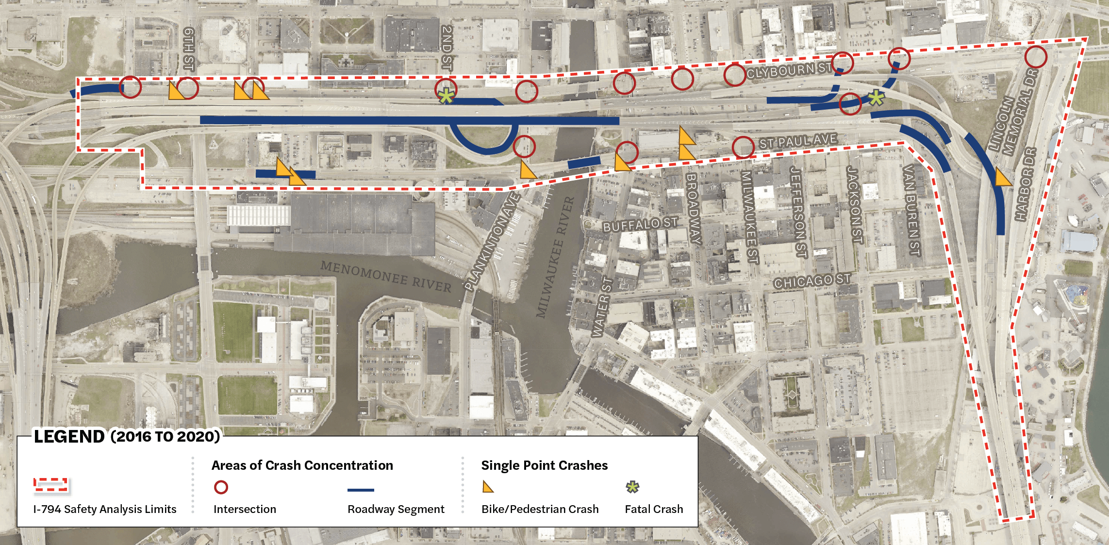
Safety Conditions
The crash rate on the I-794 mainline from the Marquette Interchange to the Hoan Bridge exceeds the statewide average crash rate for similar roadways during the five-year analysis period of 2016 to 2020.

Traffic Operations
The I-794 Lake Interchange carried 73,900 vehicles daily east of the Milwaukee River and 42,500 vehicles daily at the Hoan Bridge in 2022. Approximately 26,600 vehicles traveled through the interchange daily, using the I-794 mainline to connect to the regional freeway system.

System Linkages
I-794 connects Milwaukee’s freeway system to downtown Milwaukee, the Historic Third Ward, Milwaukee’s Lakefront, Port Milwaukee and communities along the north shore and south shore. Photo credit: Port Milwaukee

Bicycle and Pedestrian Accommodations
Bicycle and pedestrian travel is an important travel mode within the study corridor. There is a lack of continuous non-motorist infrastructure on the surface street network and multiple five-leg intersections which create potentially unsafe conflict points between pedestrians, bicyclists and motorists.

Land Use and Community Compatibility
There is an opportunity to increase community connectivity and enhance activation within Milwaukee’s downtown and Historic Third Ward neighborhoods, and improve the compatibility of transportation infrastructure with local plans and development for the Lake Interchange corridor.

Study and Project Phases


Alternative Groups
No
Build
Replace
In Kind

Freeway
Removal
Freeway
Improvement

Mobility


View August 2023 Traffic, Travel and Safety Patterns Fact Sheet
